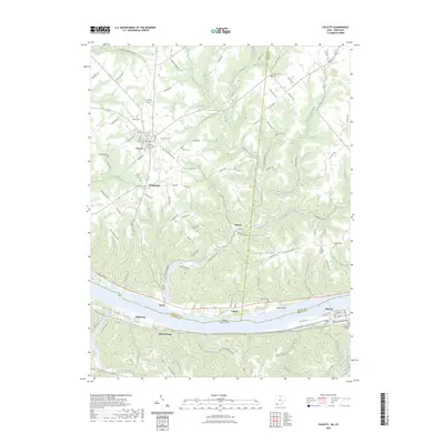
2023 Map of Felicity
USGS Topo · Published 2023About this map
Felicity serves as a primary hub for this riverside landscape, where the grid of Main ST and Mulberry ST centers a network of rural roads extending toward the Ohio River. The geography is defined by the significant dissection of the plateau by numerous waterways, including Bullskin Creek and its three branches—West Branch, Middle Branch, and East Branch—which carve deep valleys into the terrain.
Find a feature on this map
126 named features on this map. Tap any name to fly to it.
Don’t see what you’re looking for? This feature index may not catch every label — zoom into the map to look around manually.
Map Details
Editions of this 2023 Felicity Map
This is the sole edition of this map. No revisions or reprints were ever made.
Other maps of this area

1915 · Maysville
USGS Topo · 1:62,500

1919 · Maysville
USGS Topo · 1:62,500

1928 · Higginsport
USGS Topo · 1:48,000

1931 · Felicity
USGS Topo · 1:62,500

1931 · Higginsport
USGS Topo · 1:62,500

1952 · Germantown
USGS Topo · 1:24,000

1952 · Higginsport
USGS Topo · 1:24,000

1952 · Berlin
USGS Topo · 1:24,000

1952 · Brooksville
USGS Topo · 1:24,000

1953 · Laurel
USGS Topo · 1:24,000