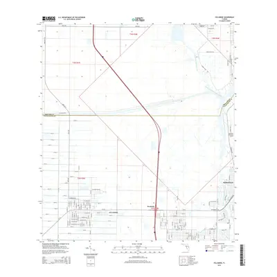
2015 Map of Fellsmere
USGS Topo · Published 2015About this map
Fellsmere serves as the focal point of this coastal Florida landscape, where a rigid grid of residential streets meets the winding natural waterways of the Treasure Coast. The transition between the organized agriculture and housing of the town and the marshy expanses of the North Prong Saint Sebastian River is clearly visible. To the east, the edge of Sebastian appears near the Sebastian Municipal Airport, while the South Prong Saint Sebastian River snakes through the southern sections. This survey documents the area's development just inland from the Atlantic, highlighting the expansion of roads like Babcock St and Micco Rd. For those researching local heritage, the Old Sebastian Cem remains a significant landmark near the riverbanks. The map also records the boundary line between Brevard Co and Indian River Co, illustrating how these administrative divisions bisect the low-lying wetlands and residential tracts.
Find a feature on this map
130 named features on this map. Tap any name to fly to it.
Don’t see what you’re looking for? This feature index may not catch every label — zoom into the map to look around manually.
Map Details
Editions of this 2015 Fellsmere Map
This is the sole edition of this map. No revisions or reprints were ever made.
Other maps of this area

1949 · Fellsmere
USGS Topo · 1:24,000

1949 · Sebastian NW
USGS Topo · 1:24,000

1949 · Vero Beach
USGS Topo · 1:24,000

1949 · Sebastian
USGS Topo · 1:24,000

1949 · Grant
USGS Topo · 1:24,000

1950 · Vero Beach
USGS Topo · 1:24,000

1951 · Sebastian NW
USGS Topo · 1:24,000

1951 · Fellsmere
USGS Topo · 1:24,000

1951 · Grant
USGS Topo · 1:24,000

1951 · Sebastian
USGS Topo · 1:24,000