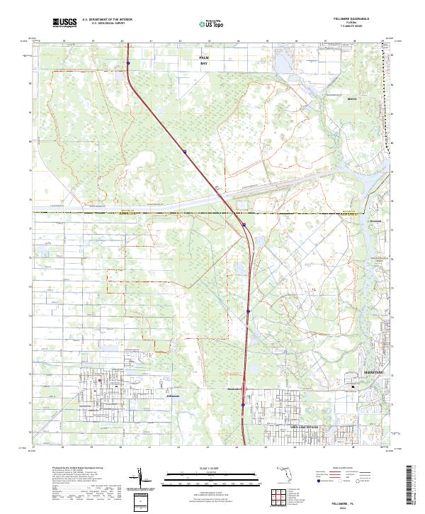
2024 Map of Fellsmere
USGS Topo · Published 2024About this map
The South Prong Saint Sebastian River and its northern counterpart wind through this landscape at the border of Brevard and Indian River counties. This contemporary survey shows the historic grid of Fellsmere and the residential expansion of Sebastian, including the Vero Lake Estates development. The presence of the Trans-Florida Rail-Trl following the old railroad alignment provides a clear link to the region's agricultural and industrial transportation history. Genealogists and local historians will find the Old Sebastian Cem and the Sebastian Municipal Airport as key landmarks of the area's development. Small settlements like Brookside, Roseland, and Willow Waters anchor different corners of the map, while the expansive St Sebastian River Preserve State Park Trl corridors highlight the conservation of the Florida wetlands and river basin.
Find a feature on this map
140 named features on this map. Tap any name to fly to it.
Don’t see what you’re looking for? This feature index may not catch every label — zoom into the map to look around manually.
Map Details
Editions of this 2024 Fellsmere Map
This is the sole edition of this map. No revisions or reprints were ever made.
Other maps of this area

1949 · Fellsmere
USGS Topo · 1:24,000

1949 · Sebastian NW
USGS Topo · 1:24,000

1949 · Vero Beach
USGS Topo · 1:24,000

1949 · Sebastian
USGS Topo · 1:24,000

1949 · Grant
USGS Topo · 1:24,000

1950 · Vero Beach
USGS Topo · 1:24,000

1951 · Sebastian NW
USGS Topo · 1:24,000

1951 · Fellsmere
USGS Topo · 1:24,000

1951 · Grant
USGS Topo · 1:24,000

1951 · Sebastian
USGS Topo · 1:24,000