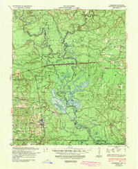
1939 Map of Felsenthal
USGS Topo · Published 1942About this map
Huttig stands as a primary industrial hub in this riverbound landscape where the Ouachita River and Saline River converge. This 1930s survey reveals a region defined by extensive timber operations, with numerous logging railroads threading through the lowlands to move cypress and hardwood. The town of Felsenthal sits at a critical junction of the river and the Missouri Pacific rail line, serving as a gateway to the complex network of sloughs and lakes like Grand Marais Lake and Open Lake. Beyond the industrial centers, the map documents a rural landscape of neighborhood institutions, including Smith Chapel and Wallace Sch, while the presence of an Indian Mound and the Theo Terzia State Game Preserve indicates a long history of land use. Significant ridges such as Oak Ridge and Gravel Ridge provide higher ground above the flood-prone basins of Lapile Creek.
Find a feature on this map
84 named features on this map. Tap any name to fly to it.
Don’t see what you’re looking for? This feature index may not catch every label — zoom into the map to look around manually.
Map Details
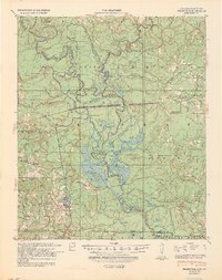
Editions of this 1939 Felsenthal Map
2 editions found
Historical Maps of Huttig Through Time
4 maps found


