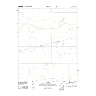
2011 Map of Felt
USGS Topo · Published 2011About this map
The settlement of Felt anchors this landscape in the Oklahoma Panhandle, situated along a central highway corridor. The geography is defined by a series of waterways, most notably the Beaver River which meanders across the northern half of the quadrangle. Smaller drainage systems like Aqua Fria Creek, Corrumpa Creek, and Seneca Creek transition through the high plains terrain, illustrating the water-scarce environment of Cimarron County. The map reveals a highly structured grid of section roads, including E0300 Rd and N0120 Rd, reflecting the region's agricultural layout. A small community hub is evidenced by the Felt Picnic Area, providing a rare public landmark in this sparsely populated cattle and farming country.
Find a feature on this map
22 named features on this map. Tap any name to fly to it.
Don’t see what you’re looking for? This feature index may not catch every label — zoom into the map to look around manually.
Map Details
Editions of this 2011 Felt Map
This is the sole edition of this map. No revisions or reprints were ever made.
Other maps of this area

1954 · Dalhart
USGS Topo · 1:250,000

1958 · Dalhart
USGS Topo · 1:250,000

1962 · Dalhart
USGS Topo · 1:250,000

1969 · Felt SW
USGS Topo · 1:24,000

1969 · Boise City NW
USGS Topo · 1:24,000

1969 · Boise City SW
USGS Topo · 1:24,000

1969 · Wheeless
USGS Topo · 1:24,000

1969 · Felt
USGS Topo · 1:24,000

1969 · Felt NE
USGS Topo · 1:24,000

1973 · Buffalo Springs
USGS Topo · 1:24,000