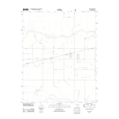
2012 Map of Felt
USGS Topo · Published 2012About this map
The settlement of Felt sits at a crossroads in the High Plains of the Oklahoma Panhandle, where the high desert landscape meets the Cimarron County section of the Beaver River. This 2012 survey illustrates the grid of rural roads and watercourses that define the region's agricultural layout. Notable hydrology includes the winding course of Aqua Fria Cr and Corrumpa Cr, which provide drainage across the arid terrain. The map details a strictly organized system of section-line roads, such as E0300 Rd and E0310 Rd, which connect the town center to the surrounding ranching and farming operations. The landscape's character is defined by wide-open spaces punctuated by these essential transportation corridors and seasonal water systems.
Find a feature on this map
13 named features on this map. Tap any name to fly to it.
Don’t see what you’re looking for? This feature index may not catch every label — zoom into the map to look around manually.
Map Details
Editions of this 2012 Felt Map
This is the sole edition of this map. No revisions or reprints were ever made.
Other maps of this area

1954 · Dalhart
USGS Topo · 1:250,000

1958 · Dalhart
USGS Topo · 1:250,000

1962 · Dalhart
USGS Topo · 1:250,000

1969 · Felt SW
USGS Topo · 1:24,000

1969 · Boise City NW
USGS Topo · 1:24,000

1969 · Boise City SW
USGS Topo · 1:24,000

1969 · Wheeless
USGS Topo · 1:24,000

1969 · Felt
USGS Topo · 1:24,000

1969 · Felt NE
USGS Topo · 1:24,000

1973 · Buffalo Springs
USGS Topo · 1:24,000