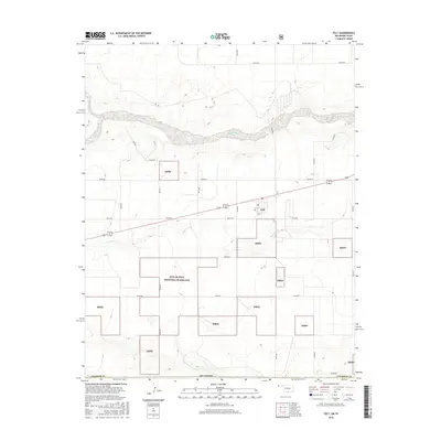
2016 Map of Felt
USGS Topo · Published 2016About this map
The high plains of the Oklahoma Panhandle define this landscape, where the small community of Felt serves as a lone hub of settlement along the highway. To the south and west, the terrain is dominated by the Rita Blanca National Grassland, a conservation area established to restore the shortgrass prairie after the Dust Bowl era. The map reveals the characteristic grid of the section-line roads, including N0090 Rd and E0310 Rd, which cut through the open rangeland. Water is a scarce but defining element here, with the Beaver River and the ephemeral Aqua Fria Cr winding through the grasslands. These drainages provide subtle topographic relief in an otherwise expansive horizon, indicating the vital role of water management in this arid ranching and conservation corridor near the Texas border.
Find a feature on this map
25 named features on this map. Tap any name to fly to it.
Don’t see what you’re looking for? This feature index may not catch every label — zoom into the map to look around manually.
Map Details
Editions of this 2016 Felt Map
This is the sole edition of this map. No revisions or reprints were ever made.
Other maps of this area

1954 · Dalhart
USGS Topo · 1:250,000

1958 · Dalhart
USGS Topo · 1:250,000

1962 · Dalhart
USGS Topo · 1:250,000

1969 · Felt SW
USGS Topo · 1:24,000

1969 · Boise City NW
USGS Topo · 1:24,000

1969 · Boise City SW
USGS Topo · 1:24,000

1969 · Wheeless
USGS Topo · 1:24,000

1969 · Felt
USGS Topo · 1:24,000

1969 · Felt NE
USGS Topo · 1:24,000

1973 · Buffalo Springs
USGS Topo · 1:24,000