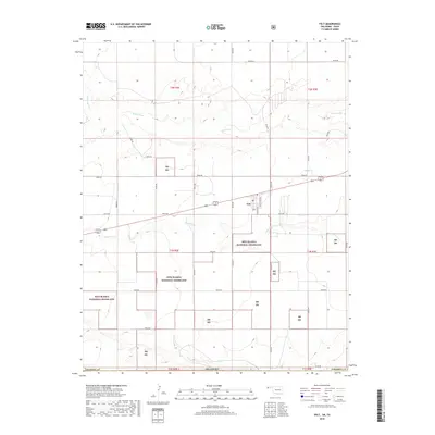
2018 Map of Felt
USGS Topo · Published 2018About this map
Felt stands as a primary settlement in this corner of the Oklahoma Panhandle, situated along a grid of section roads and the local Po. The landscape is defined by the expansive Rita Blanca National Grassland, which occupies significant portions of the southern half of the map. This area of Cimarron County shows a distinct transition between the agricultural upland plateaus and the drainage basins of the Beaver River and Corrumpa Creek. The topography is marked by the meandering path of Aqua Fria Cr, which cuts through the grassland sections toward the southeast. The rigid survey lines of the Public Land Survey System, including t1n r2e and t2n r3e, contrast with the natural hydrology, reflecting the late 20th and early 21st-century land management patterns of this high plains region.
Find a feature on this map
33 named features on this map. Tap any name to fly to it.
Don’t see what you’re looking for? This feature index may not catch every label — zoom into the map to look around manually.
Map Details
Editions of this 2018 Felt Map
This is the sole edition of this map. No revisions or reprints were ever made.
Other maps of this area

1954 · Dalhart
USGS Topo · 1:250,000

1958 · Dalhart
USGS Topo · 1:250,000

1962 · Dalhart
USGS Topo · 1:250,000

1969 · Felt SW
USGS Topo · 1:24,000

1969 · Boise City NW
USGS Topo · 1:24,000

1969 · Boise City SW
USGS Topo · 1:24,000

1969 · Wheeless
USGS Topo · 1:24,000

1969 · Felt
USGS Topo · 1:24,000

1969 · Felt NE
USGS Topo · 1:24,000

1973 · Buffalo Springs
USGS Topo · 1:24,000