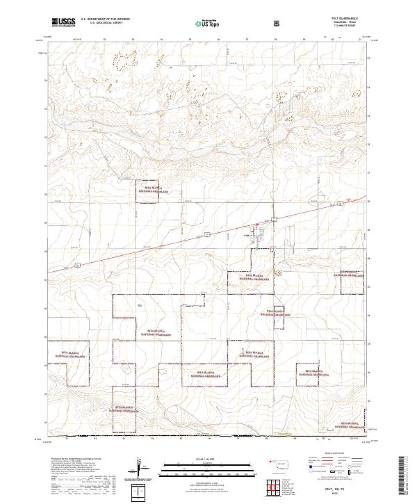
2022 Map of Felt
USGS Topo · Published 2022About this map
Felt stands as a distinct settlement in the Oklahoma Panhandle, where the grid of Lincoln Ave and Madison Ave meets the sweeping landscape of the High Plains. This 2022 survey captures a region defined by its vast conservation areas and sparse, rural infrastructure. Much of the southern and central terrain is preserved within the Rita Blanca National Grassland, a fragmented expanse of public land that protects the shortgrass prairie ecosystem. The topography is shaped by the east-flowing Beaver River and Cieneguilla Creek, which carve gentle depressions across the plains. Outside the small residential cluster of Felt, the land is partitioned by a strict section-line road system including Felt Rd and E0300 Rd, reflecting the enduring legacy of the Public Land Survey System in Cimarron County.
Find a feature on this map
30 named features on this map. Tap any name to fly to it.
Don’t see what you’re looking for? This feature index may not catch every label — zoom into the map to look around manually.
Map Details
Editions of this 2022 Felt Map
This is the sole edition of this map. No revisions or reprints were ever made.
Other maps of this area

1954 · Dalhart
USGS Topo · 1:250,000

1958 · Dalhart
USGS Topo · 1:250,000

1962 · Dalhart
USGS Topo · 1:250,000

1969 · Felt SW
USGS Topo · 1:24,000

1969 · Boise City NW
USGS Topo · 1:24,000

1969 · Boise City SW
USGS Topo · 1:24,000

1969 · Wheeless
USGS Topo · 1:24,000

1969 · Felt
USGS Topo · 1:24,000

1969 · Felt NE
USGS Topo · 1:24,000

1973 · Buffalo Springs
USGS Topo · 1:24,000