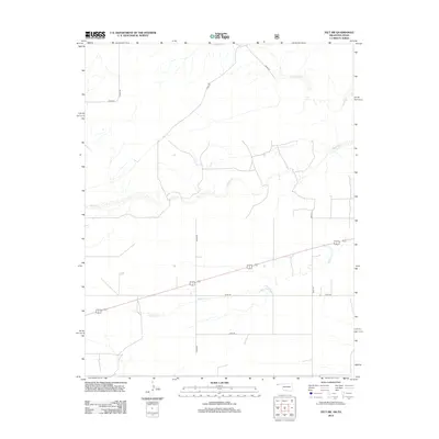
2012 Map of Felt SW
USGS Topo · Published 2012About this map
Aqua Fria Cr winds through the southwestern corner of Cimarron County, carving a subtle drainage pattern across this high plains landscape. The terrain is defined by its wide, open spaces and a strictly cardinal road network, including thoroughfares like N0040 Rd and E0330 Rd. These section-line roads illustrate the systematic agricultural and ranching layout characteristic of the Oklahoma Panhandle, where large tracts of land are partitioned for livestock and dryland farming. In the northern reaches, the seasonal watercourses of Corrumpa Cr and Seneca Cr introduce topographical variety to the otherwise level horizon. This 2012 survey by the U.S. Geological Survey documents the sparse but resilient infrastructure of a region where water sources and reliable roads like D0288 Rd remain the primary landmarks for navigation and land management.
Find a feature on this map
11 named features on this map. Tap any name to fly to it.
Don’t see what you’re looking for? This feature index may not catch every label — zoom into the map to look around manually.
Map Details
Editions of this 2012 Felt SW Map
This is the sole edition of this map. No revisions or reprints were ever made.
Other maps of this area

1954 · Dalhart
USGS Topo · 1:250,000

1958 · Dalhart
USGS Topo · 1:250,000

1962 · Dalhart
USGS Topo · 1:250,000

1969 · Felt SW
USGS Topo · 1:24,000

1969 · Wheeless
USGS Topo · 1:24,000

1969 · Felt
USGS Topo · 1:24,000

1969 · Felt NE
USGS Topo · 1:24,000

1970 · Texline North
USGS Topo · 1:24,000

1972 · Rardin Hill
USGS Topo · 1:24,000

1972 · Moses
USGS Topo · 1:24,000