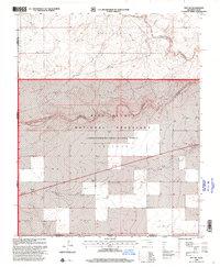
1998 Map of Felt SW
USGS Topo · Published 2001About this map
Rita Blanca National Grassland dominates this landscape along the high plains where Oklahoma, Texas, and New Mexico meet. The map documents a sparsely settled but strategically significant territory, featuring the USCG Loran-Tac-C Station in the southern portion near the Texas border. The drainage patterns are defined by the Corrumpa River and Seneca Creek, which cut through the terrain labels of Wheeless and Gresham. These labels represent the expansive open country of Cimarron County, where water features like Aqua Fria Creek and isolated markers such as a Flowing Well or a Gravel Pit indicate the local ranching and transit economy. A Roadside Park along the primary roadway offers a rare point of public utility in this vast grassland environment.
Find a feature on this map
15 named features on this map. Tap any name to fly to it.
Don’t see what you’re looking for? This feature index may not catch every label — zoom into the map to look around manually.
Map Details
Editions of this 1998 Felt SW Map
This is the sole edition of this map. No revisions or reprints were ever made.
Other maps of this area

1954 · Dalhart
USGS Topo · 1:250,000

1958 · Dalhart
USGS Topo · 1:250,000

1962 · Dalhart
USGS Topo · 1:250,000

1969 · Felt SW
USGS Topo · 1:24,000

1969 · Wheeless
USGS Topo · 1:24,000

1969 · Felt
USGS Topo · 1:24,000

1969 · Felt NE
USGS Topo · 1:24,000

1970 · Texline North
USGS Topo · 1:24,000

1972 · Rardin Hill
USGS Topo · 1:24,000

1972 · Moses
USGS Topo · 1:24,000