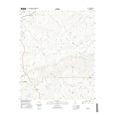
2017 Map of Felton
USGS Topo · Published 2017About this map
Morgan Valley carves a path through the southern foothills of the Appalachians, where the Polk and Haralson county line divides the landscape. This region, captured during the late twenty-tens, centers on the crossroads at Antioch and the community of Felton, which serves as a landmark for those tracing family roots through the Felton Cem and Mount Zion East Church Cem. The terrain is defined by prominent ridges such as Dugdown Mtn and Hightower Mtn, while the water network of Euharlee Cr and the scenic Hightower Falls indicates a legacy of water-driven utility and local recreation.
Find a feature on this map
108 named features on this map. Tap any name to fly to it.
Don’t see what you’re looking for? This feature index may not catch every label — zoom into the map to look around manually.
Map Details
Editions of this 2017 Felton Map
This is the sole edition of this map. No revisions or reprints were ever made.
Other maps of this area

1886 · Rome
USGS Topo · 1:125,000

1889 · Tallapoosa
USGS Topo · 1:125,000

1892 · Tallapoosa
USGS Topo · 1:125,000

1897 · Tallapoosa
USGS Topo · 1:125,000

1898 · Rome
USGS Topo · 1:125,000

1899 · Rome
USGS Topo · 1:125,000

1904 · Rome
USGS Topo · 1:125,000

1953 · Atlanta
USGS Topo · 1:250,000

1955 · Rome
USGS Topo · 1:250,000

1957 · Atlanta
USGS Topo · 1:250,000