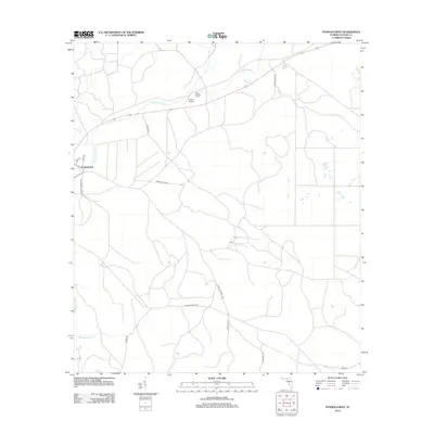
2012 Map of Fenholloway
USGS Topo · Published 2012About this map
The Fenholloway River snakes through this Taylor County landscape, defining the character of a region marked by extensive road networks and rural infrastructure. The small settlement of Fenholloway sits in the western portion of the map, serving as a focal point for local travel along Cooks Hammond Rd and Co Rd-327. Industry and surveillance are evident in the northern reaches, where the Foley Lookout Tower stands near the Circle P Airport, signaling the area's role in forestry management and local aviation.
Find a feature on this map
17 named features on this map. Tap any name to fly to it.
Don’t see what you’re looking for? This feature index may not catch every label — zoom into the map to look around manually.
Map Details
Editions of this 2012 Fenholloway Map
This is the sole edition of this map. No revisions or reprints were ever made.
Other maps of this area

1954 · Fenholloway
USGS Topo · 1:24,000

1954 · Day SE
USGS Topo · 1:24,000

1954 · Day
USGS Topo · 1:24,000

1954 · Cooks Hammock
USGS Topo · 1:24,000

1954 · Warrior Swamp
USGS Topo · 1:24,000

1954 · Salem
USGS Topo · 1:24,000

1954 · Boyd
USGS Topo · 1:24,000

1954 · Day NW
USGS Topo · 1:24,000

1954 · Gainesville
USGS Topo · 1:250,000

1954 · Valdosta
USGS Topo · 1:250,000