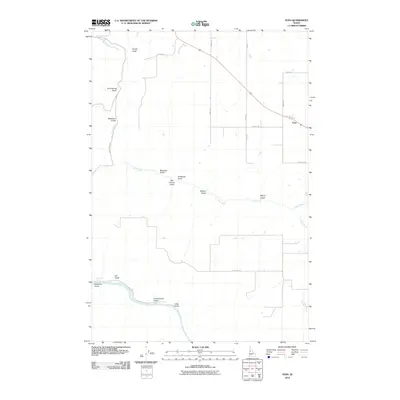
2010 Map of Fenn
USGS Topo · Published 2010About this map
The Salmon River cuts through the southwestern corner of this Idaho County landscape, where the high plateau of the Camas Prairie meets the deep drainage systems of the Camas and Rock Creek watersheds. Near the turn of the 21st century, the small settlement of Fenn remains a primary focal point along the highway, serving as a hub for the surrounding agricultural community. The terrain is defined by a dense network of gulches named for local families and natural features, such as Hanley Gulch, Blackburn Gulch, and Ray Church Gulch. These landforms dictate the local road network, which includes routes like Gill Point Rd and Camas Rd. Researchers can trace the water sources vital to the region, from the seasonal flow of Grave Creek to the reliable waters of Murdicks Spring.
Find a feature on this map
27 named features on this map. Tap any name to fly to it.
Don’t see what you’re looking for? This feature index may not catch every label — zoom into the map to look around manually.
Map Details
Editions of this 2010 Fenn Map
This is the sole edition of this map. No revisions or reprints were ever made.
Other maps of this area

1924 · Kamiah
USGS Topo · 1:125,000

1955 · Pullman
USGS Topo · 1:250,000

1955 · Grangeville
USGS Topo · 1:250,000

1958 · Pullman
USGS Topo · 1:250,000

1959 · Grangeville
USGS Topo · 1:250,000

1963 · Grangeville West
USGS Topo · 1:24,000

1963 · White Bird Hill
USGS Topo · 1:24,000

1963 · Moughmer Point
USGS Topo · 1:24,000

1963 · Joseph
USGS Topo · 1:24,000

1963 · White Bird
USGS Topo · 1:24,000