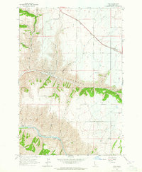
1963 Map of Fenn
USGS Topo · Published 1965About this map
Camas Prairie defines the northern plateau of this 1963 survey, where the small settlement of Fenn sits along the roadway before the landscape drops dramatically into the deep drainages of Rocky Canyon. The map illustrates a sharp transition from the agricultural level lands of the prairie to the steep, complex terrain of the Idaho interior. In the southern portion of the sheet, the Salmon River carves a winding path through the canyon floor, marked by the turbulent Pine Bar Rapids and the confluence of Cottonwood Creek. Numerous named gulches, such as VonBerge Gulch and Ray Church Gulch, underscore the fractured nature of the geography leading down to the river. Remote springs like Murdicks Spring and high points like Hogback Ridge provide essential landmarks for navigating this vertical landscape between the prairie and the basin.
Find a feature on this map
27 named features on this map. Tap any name to fly to it.
Don’t see what you’re looking for? This feature index may not catch every label — zoom into the map to look around manually.
Map Details
Editions of this 1963 Fenn Map
This is the sole edition of this map. No revisions or reprints were ever made.
Other maps of this area

1924 · Kamiah
USGS Topo · 1:125,000

1955 · Pullman
USGS Topo · 1:250,000

1955 · Grangeville
USGS Topo · 1:250,000

1958 · Pullman
USGS Topo · 1:250,000

1959 · Grangeville
USGS Topo · 1:250,000

1963 · Grangeville West
USGS Topo · 1:24,000

1963 · White Bird Hill
USGS Topo · 1:24,000

1963 · Moughmer Point
USGS Topo · 1:24,000

1963 · Joseph
USGS Topo · 1:24,000

1963 · White Bird
USGS Topo · 1:24,000