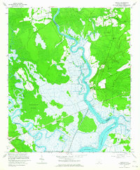
1960 Map of Fenwick
USGS Topo · Published 1964About this map
The Ashepoo River and Edisto River dominate this Lowcountry landscape, winding through a complex network of wetlands and tidal flats. The 1960 field-checked data captures the area as it transitioned from an older agrarian and riverine economy into a managed conservation landscape, evidenced by the Bear Island Game Management Area. Small rural communities and church-centered settlements like Bowman, Willtown, and Fenwick are scattered across the higher ground, often connected by the Seaboard Air Line railroad corridor.
Find a feature on this map
32 named features on this map. Tap any name to fly to it.
Don’t see what you’re looking for? This feature index may not catch every label — zoom into the map to look around manually.
Map Details
Editions of this 1960 Fenwick Map
2 editions found
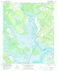
Other maps of this area

1918 · Walterboro
USGS Topo · 1:62,500

1918 · Green Pond
USGS Topo · 1:62,500

1918 · Cottageville
USGS Topo · 1:62,500

1919 · Edisto Island
USGS Topo · 1:62,500

1943 · Cottageville
USGS Topo · 1:62,500

1943 · Edisto Island
USGS Topo · 1:62,500

1943 · Green Pond
USGS Topo · 1:62,500

1943 · Walterboro
USGS Topo · 1:62,500

1947 · Savannah
USGS Topo · 1:250,000

1948 · Savannah
USGS Topo · 1:250,000