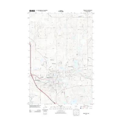
2013 Map of Fergus Falls
USGS Topo · Published 2013About this map
The Otter Tail River winds through the heart of Fergus Falls, creating a landscape defined by its numerous reservoirs and glacial lakes. This 2013 survey illustrates the dense concentration of community institutions and burial sites that reflect the area's long-term development, from the Otter Tail County Fairgrounds to the Minnesota State Community And Technical Coll. Of particular interest to local historians is the State Hospital for the Insane Cem, a significant landmark documenting the social history of the region.
Find a feature on this map
84 named features on this map. Tap any name to fly to it.
Don’t see what you’re looking for? This feature index may not catch every label — zoom into the map to look around manually.
Map Details
Editions of this 2013 Fergus Falls Map
This is the sole edition of this map. No revisions or reprints were ever made.
Other maps of this area

1910 · Wendell
USGS Topo · 1:62,500

1913 · Ashby
USGS Topo · 1:62,500

1913 · Fergus Falls
USGS Topo · 1:62,500

1913 · Wendell
USGS Topo · 1:62,500

1915 · Underwood
USGS Topo · 1:62,500

1953 · Fargo
USGS Topo · 1:250,000

1953 · Brainerd
USGS Topo · 1:250,000

1956 · Fargo
USGS Topo · 1:250,000

1957 · Brainerd
USGS Topo · 1:250,000

1958 · Brainerd
USGS Topo · 1:250,000
Featured Places
- Fergus Falls, MN
- Dane Prairie Township, MN
- Fergus Falls Township, MN
- Buse Township, MN
- Aurdal Township, MN