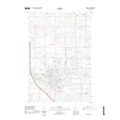
2019 Map of Fergus Falls
USGS Topo · Published 2019About this map
Fergus Falls serves as the central hub of this Otter Tail County survey, where the Pelican River and Otter Tail River converge amidst a landscape heavily dotted with glacial lakes. The town's institutional history is prominently marked by the State Hospital for the Insane Cem, a significant site for local history researchers and genealogists. Educational and residential growth is evident through the presence of the Minnesota State Community and Technical College and developments like Lakeview Ests. Numerous smaller water bodies, including Lake Alice, Grotto Lake, and Hoot Lake, define the local geography, while a high concentration of denominational burial grounds, such as Immanuel Lutheran Church Cem and Our Lady of Victory Catholic Church Cem, reflect the area's deep-rooted community foundations and religious heritage.
Find a feature on this map
94 named features on this map. Tap any name to fly to it.
Don’t see what you’re looking for? This feature index may not catch every label — zoom into the map to look around manually.
Map Details
Editions of this 2019 Fergus Falls Map
This is the sole edition of this map. No revisions or reprints were ever made.
Other maps of this area

1910 · Wendell
USGS Topo · 1:62,500

1913 · Ashby
USGS Topo · 1:62,500

1913 · Fergus Falls
USGS Topo · 1:62,500

1913 · Wendell
USGS Topo · 1:62,500

1915 · Underwood
USGS Topo · 1:62,500

1953 · Fargo
USGS Topo · 1:250,000

1953 · Brainerd
USGS Topo · 1:250,000

1956 · Fargo
USGS Topo · 1:250,000

1957 · Brainerd
USGS Topo · 1:250,000

1958 · Brainerd
USGS Topo · 1:250,000
Featured Places
- Fergus Falls, MN
- Dane Prairie Township, MN
- Fergus Falls Township, MN
- Buse Township, MN
- Aurdal Township, MN