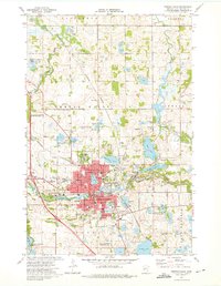
1973 Map of Fergus Falls
USGS Topo · Published 1975About this map
The city of Fergus Falls serves as the focal point of this mid-1970s survey, illustrating a landscape defined by the winding course of the Otter Tail River and the industrial presence of the Burlington Northern railroad. The map documents significant local institutions including the sprawling campus of the Fergus Falls State Hospital and the nearby Fergus Falls State Jr College. The terrain is characterized by a dense distribution of water bodies and wetlands, from the large Dayton Hollow Reservoir in the southwest to smaller lakes like Lake Alice and Hoot Lake. Genealogists will find numerous family-history touchpoints, such as Bethlehem Cem and Oak Grove Cem, alongside several neighborhood schools including the McKinley Sch and Lincoln Sch. Leisure and infrastructure are noted through features like the Drive-in Theater, a Ski lift, and the Waterworks Aqueduct near Lake Wright.
Find a feature on this map
69 named features on this map. Tap any name to fly to it.
Don’t see what you’re looking for? This feature index may not catch every label — zoom into the map to look around manually.
Map Details
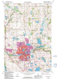
Editions of this 1973 Fergus Falls Map
2 editions found
Other maps of this area

1910 · Wendell
USGS Topo · 1:62,500

1913 · Ashby
USGS Topo · 1:62,500

1913 · Fergus Falls
USGS Topo · 1:62,500

1913 · Wendell
USGS Topo · 1:62,500

1915 · Underwood
USGS Topo · 1:62,500

1953 · Fargo
USGS Topo · 1:250,000

1953 · Brainerd
USGS Topo · 1:250,000

1956 · Fargo
USGS Topo · 1:250,000

1957 · Brainerd
USGS Topo · 1:250,000

1958 · Brainerd
USGS Topo · 1:250,000
Featured Places
- Fergus Falls, MN
- Lakeview Estates, Fergus Falls
- Buse Township, MN
- Dane Prairie Township, MN
- River Bluff Estates, Fergus Falls