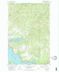
1981 Map of Fernan Lake
USGS Topo · Published 1981About this map
Fernan Lake and the northeastern reaches of Coeur d'Alene Lake anchor this topographic survey from the early 1980s. The landscape is defined by the steep transition from the residential growth of Dalton Gardens and Fernan Lake Village into the densely timbered terrain of the Coeur d'Alene National Forest. Historic transportation corridors are clearly marked, including the legendary Mullan Trail winding through the hills and the Yellowstone Trail skirting the southern shorelines. Local topography is punctuated by prominent peaks such as West Canfield Butte and Kern Butte, while the shoreline is broken by the deep waters of Wolf Lodge Bay and Bennett Bay. A network of gulches, such as French Gulch and Nettleton Gulch, illustrates the complex drainage patterns feeding into the lakes from the surrounding mountains.
Find a feature on this map
53 named features on this map. Tap any name to fly to it.
Don’t see what you’re looking for? This feature index may not catch every label — zoom into the map to look around manually.
Map Details
Editions of this 1981 Fernan Lake Map
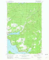
2 editions found
Other maps of this area

1903 · Rathdrum
USGS Topo · 1:125,000

1955 · Spokane
USGS Topo · 1:250,000

1957 · Coeur D'Alene
USGS Topo · 1:62,500

1957 · Lane
USGS Topo · 1:62,500

1958 · Spokane
USGS Topo · 1:250,000

1961 · Hayden
USGS Topo · 1:24,000

1961 · Spirit Lake
USGS Topo · 1:62,500

1961 · Athol
USGS Topo · 1:62,500

1961 · Hayden Lake
USGS Topo · 1:24,000

1975 · Coeur D'Alene SE
USGS Topo · 1:24,000