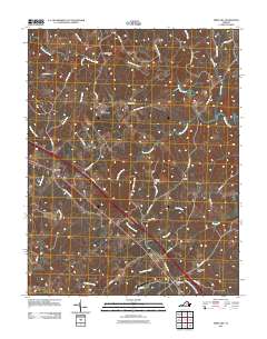
2011 Map of Ferncliff
USGS Topo · Published 2011About this map
The South Anna River meanders across this central Virginia landscape, defining a rural corridor marked by historic road junctions and small crossroads communities. Bells Crossroads and Butlers Store anchor the northern reaches of the quadrangle, where the land is carved by numerous drainages including Reedy Creek and Rock Creek. These waterways once supported local industry and commerce, evidenced by the presence of Byrd Mill near the river's edge.
Find a feature on this map
45 named features on this map. Tap any name to fly to it.
Don’t see what you’re looking for? This feature index may not catch every label — zoom into the map to look around manually.
Map Details
Editions of this 2011 Ferncliff Map
This is the sole edition of this map. No revisions or reprints were ever made.
Other maps of this area

1887 · Spottsylvania
USGS Topo · 1:125,000

1890 · Goochland
USGS Topo · 1:125,000

1891 · Palmyra
USGS Topo · 1:125,000

1892 · Spottsylvania
USGS Topo · 1:125,000

1892 · Goochland
USGS Topo · 1:125,000

1892 · Gordonsville
USGS Topo · 1:125,000

1895 · Palmyra
USGS Topo · 1:125,000

1897 · Palmyra
USGS Topo · 1:125,000

1942 · Mineral
USGS Topo · 1:31,680

1942 · Pendleton
USGS Topo · 1:24,000