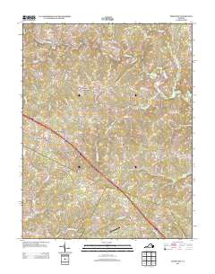
2013 Map of Ferncliff
USGS Topo · Published 2013About this map
S Anna River winds through the northern reaches of this Louisa County landscape, anchoring a rural territory defined by scattered crossroads and historical watercourses. The local road network converges at hubs like Bells Crossroads and the community of Ferncliff, where the intersection of Interstate 64 and U.S. Highway 250 serves as a modern corridor through an area otherwise characterized by traditional land use and drainage systems. To the southeast, Shannon Hill and the neighboring Shannon Hills mark a notable concentration of settlement near the headwaters of S Br Fork Cr. The presence of Payne Airport near Rattlesnake Run suggests a blend of aviation and agriculture. This region is etched with numerous named streams, including Venable Cr and Roundabout Cr, which illustrate the complex local hydrology feeding into larger Virginian river systems.
Find a feature on this map
75 named features on this map. Tap any name to fly to it.
Don’t see what you’re looking for? This feature index may not catch every label — zoom into the map to look around manually.
Map Details
Editions of this 2013 Ferncliff Map
This is the sole edition of this map. No revisions or reprints were ever made.
Other maps of this area

1887 · Spottsylvania
USGS Topo · 1:125,000

1890 · Goochland
USGS Topo · 1:125,000

1891 · Palmyra
USGS Topo · 1:125,000

1892 · Spottsylvania
USGS Topo · 1:125,000

1892 · Goochland
USGS Topo · 1:125,000

1892 · Gordonsville
USGS Topo · 1:125,000

1895 · Palmyra
USGS Topo · 1:125,000

1897 · Palmyra
USGS Topo · 1:125,000

1942 · Mineral
USGS Topo · 1:31,680

1942 · Pendleton
USGS Topo · 1:24,000