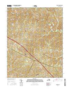
2016 Map of Ferncliff
USGS Topo · Published 2016About this map
Ferncliff stands at the intersection of modern transit and historic rural boundaries, situated where the borders of Louisa, Fluvanna, and Goochland counties converge. This 2016 record shows a landscape defined by the drainage of the South Anna River in the north and Fork Cr in the south, with the terrain rising toward Table Top Aly in the east. Small, long-standing settlements like Bells Crossroads and Shannon Hill are connected by a network of named roads including Three Notch Rd and Old Mountain Rd. The presence of Grubbs Cem and Byrd Mill, located near Byrd Millpond, provides specific points of interest for genealogists and local historians tracking family landholdings and early industry. Transportation infrastructure ranges from the small Payne Airport to the major corridor of Interstate 64, which bisects the quadrangle.
Find a feature on this map
85 named features on this map. Tap any name to fly to it.
Don’t see what you’re looking for? This feature index may not catch every label — zoom into the map to look around manually.
Map Details
Editions of this 2016 Ferncliff Map
This is the sole edition of this map. No revisions or reprints were ever made.
Other maps of this area

1887 · Spottsylvania
USGS Topo · 1:125,000

1890 · Goochland
USGS Topo · 1:125,000

1891 · Palmyra
USGS Topo · 1:125,000

1892 · Spottsylvania
USGS Topo · 1:125,000

1892 · Goochland
USGS Topo · 1:125,000

1892 · Gordonsville
USGS Topo · 1:125,000

1895 · Palmyra
USGS Topo · 1:125,000

1897 · Palmyra
USGS Topo · 1:125,000

1942 · Mineral
USGS Topo · 1:31,680

1942 · Pendleton
USGS Topo · 1:24,000