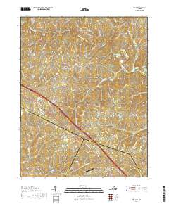
2019 Map of Ferncliff
USGS Topo · Published 2019About this map
Byrd Mill and Bells Crossroads anchor the northern landscape of this Louisa County quadrangle, where the South Anna River and its tributaries like Harris Creek carve through the central Virginia Piedmont. This modern survey illustrates a rural geography defined by long-established road networks such as Courthouse Rd and Three Notch Rd, the latter of which runs through the community of Ferncliff. The intersection of Louisa, Fluvanna, and Goochland counties occurs in the southern portion of the map, marked by a convergence of watercourses including Venable Creek and Rattlesnake Run. Further south, the settlement of Shannon Hill sits near the Goochland border, while the small Grubbs Cem and Payne Airport provide specific points of interest for genealogists and local historians tracing the area's 21st-century development.
Find a feature on this map
84 named features on this map. Tap any name to fly to it.
Don’t see what you’re looking for? This feature index may not catch every label — zoom into the map to look around manually.
Map Details
Editions of this 2019 Ferncliff Map
This is the sole edition of this map. No revisions or reprints were ever made.
Other maps of this area

1887 · Spottsylvania
USGS Topo · 1:125,000

1890 · Goochland
USGS Topo · 1:125,000

1891 · Palmyra
USGS Topo · 1:125,000

1892 · Spottsylvania
USGS Topo · 1:125,000

1892 · Goochland
USGS Topo · 1:125,000

1892 · Gordonsville
USGS Topo · 1:125,000

1895 · Palmyra
USGS Topo · 1:125,000

1897 · Palmyra
USGS Topo · 1:125,000

1942 · Mineral
USGS Topo · 1:31,680

1942 · Pendleton
USGS Topo · 1:24,000