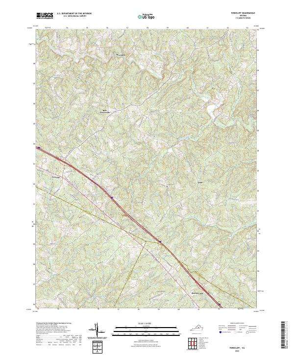
2022 Map of Ferncliff
USGS Topo · Published 2022About this map
Bells Crossroads and the surrounding Virginia countryside sit at the intersection of numerous historic transit corridors where Louisa, Fluvanna, and Goochland counties meet. The landscape is defined by the winding course of the South Anna River in the north and the complex drainage of the Little River and Roundabout Cr through the central hills. Long-established nodes like Ferncliff and Shannon Hill follow the path of Three Notch Rd, a route reflecting the area's deep-rooted settlement patterns. Family history and local landmarks are preserved through labels such as Grubbs Cem, the industrial site at Byrd Mill, and the small Payne Airport. The topography shows a transition from well-watered river bottoms to higher, ridged terrain near Quail, where creeks like Critter Cove and Rattlesnake Run carve through the woodland and farm tracts.
Find a feature on this map
85 named features on this map. Tap any name to fly to it.
Don’t see what you’re looking for? This feature index may not catch every label — zoom into the map to look around manually.
Map Details
Editions of this 2022 Ferncliff Map
This is the sole edition of this map. No revisions or reprints were ever made.
Other maps of this area

1887 · Spottsylvania
USGS Topo · 1:125,000

1890 · Goochland
USGS Topo · 1:125,000

1891 · Palmyra
USGS Topo · 1:125,000

1892 · Spottsylvania
USGS Topo · 1:125,000

1892 · Goochland
USGS Topo · 1:125,000

1892 · Gordonsville
USGS Topo · 1:125,000

1895 · Palmyra
USGS Topo · 1:125,000

1897 · Palmyra
USGS Topo · 1:125,000

1942 · Mineral
USGS Topo · 1:31,680

1942 · Pendleton
USGS Topo · 1:24,000