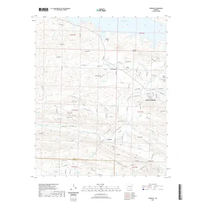
2020 Map of Ferndale
USGS Topo · Published 2020About this map
Ferndale and Northpoint sit at the center of this landscape west of Little Rock, where the winding course of the Little Maumelle River carves through a series of prominent peaks and ridges. The topography is defined by significant elevations such as Maumelle Pinnacles, Goodson Mtn, and Shinall Mtn, which frame the valley floors and the expansive waters of Lake Maumelle to the north. This modern survey illustrates the residential expansion into the hills, showing a dense network of roads like Ferndale Cutoff Rd and Cantrell Rd that connect rural settlements with the growing outskirts of the city.
Find a feature on this map
126 named features on this map. Tap any name to fly to it.
Don’t see what you’re looking for? This feature index may not catch every label — zoom into the map to look around manually.
Map Details
Editions of this 2020 Ferndale Map
This is the sole edition of this map. No revisions or reprints were ever made.
Other maps of this area

1890 · Benton
USGS Topo · 1:125,000

1891 · Little Rock
USGS Topo · 1:125,000

1893 · Little Rock
USGS Topo · 1:125,000

1894 · Benton
USGS Topo · 1:125,000

1935 · Alexander
USGS Topo · 1:48,000

1938 · Benton
USGS Topo · 1:48,000

1941 · Alexander
USGS Topo · 1:62,500

1943 · Pinnacle Mtn
USGS Topo · 1:31,680

1944 · Benton
USGS Topo · 1:62,500

1944 · Alexander
USGS Topo · 1:31,680