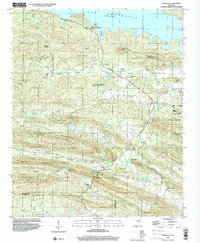
1994 Map of Ferndale
USGS Topo · Published 2000About this map
The rugged hills and valleys of western Pulaski County are defined by the Lake Maumelle shoreline and the winding course of the Little Maumelle River. In this 1990s-era study, the settlement of Ferndale serves as a central point in a landscape marked by a heavy concentration of recreation and community sites, including Ferncliff Camp, Arkansas Baptist Camp, and Pfeifer Camp. The topography is dominated by prominent ridges like Buzzard Mountain and Shinall Mountain, which steer the drainage of creeks like Nowlin Creek and Kinley Creek.
Find a feature on this map
43 named features on this map. Tap any name to fly to it.
Don’t see what you’re looking for? This feature index may not catch every label — zoom into the map to look around manually.
Map Details
Editions of this 1994 Ferndale Map
This is the sole edition of this map. No revisions or reprints were ever made.
Other maps of this area

1890 · Benton
USGS Topo · 1:125,000

1891 · Little Rock
USGS Topo · 1:125,000

1893 · Little Rock
USGS Topo · 1:125,000

1894 · Benton
USGS Topo · 1:125,000

1935 · Alexander
USGS Topo · 1:48,000

1938 · Benton
USGS Topo · 1:48,000

1941 · Alexander
USGS Topo · 1:62,500

1943 · Pinnacle Mtn
USGS Topo · 1:31,680

1944 · Benton
USGS Topo · 1:62,500

1944 · Alexander
USGS Topo · 1:31,680