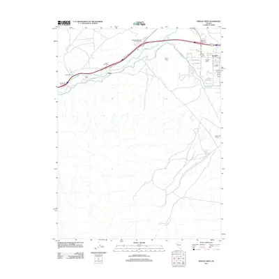
2011 Map of Fernley West
USGS Topo · Published 2011About this map
The Truckee River carves a path through the northern reaches of this Lyon County landscape, where the agricultural legacy of the Fernley area meets modern transportation infrastructure. In the early 21st century, the expansion of the western high desert is evident in the residential developments of Fernley Valley, while the vital Truckee Canal and K2B Canal continue to manage water across the arid terrain. The map traces the corridor of Interstate 80, showing major transit points like the Painted Rock Interchange and the Wadsworth-Pyramid Lake Interchange. Local landmarks such as the Fernley Post Office and Tiger Field Airport mark the community's civic and aviation hubs. Further west, the settlement of Gilpin and the Smith Ranch indicate the historical mix of ranching and roadside waypoints that have long defined this part of the Nevada desert.
Find a feature on this map
27 named features on this map. Tap any name to fly to it.
Don’t see what you’re looking for? This feature index may not catch every label — zoom into the map to look around manually.
Map Details
Editions of this 2011 Fernley West Map
This is the sole edition of this map. No revisions or reprints were ever made.
Other maps of this area

1890 · Wadsworth
USGS Topo · 1:125,000

1891 · Wabuska
USGS Topo · 1:125,000

1892 · Wadsworth
USGS Topo · 1:125,000

1894 · Wadsworth
USGS Topo · 1:125,000

1894 · Wabuska
USGS Topo · 1:125,000

1957 · Churchill Butte
USGS Topo · 1:62,500

1957 · Two Tips
USGS Topo · 1:62,500

1957 · Wadsworth
USGS Topo · 1:62,500

1957 · Silver Springs
USGS Topo · 1:62,500

1957 · Reno
USGS Topo · 1:250,000