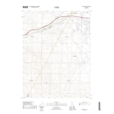
2018 Map of Fernley West
USGS Topo · Published 2018About this map
The Truckee River carves through the northern portion of this landscape, serving as a vital corridor where Washoe, Storey, and Lyon counties converge. This 2018 survey illustrates the complex water management of the region, featuring the Truckee Canal and V2B Canal that support the growing residential developments of Fernley Valley. In the northwest, the settlement of Gilpin sits along the river's path as it enters the more arid expanses to the east. The southern half of the map is dominated by the high elevations of the Virginia Range, a stark contrast to the edge of the Fortymile Desert visible in the northeast. Small, isolated water sources like Freeman Spring and Horse Spring are noted in the more remote southern terrain, while a dense network of local roads such as Cantlon Dr and Saddlehorn Dr marks the area's modern expansion.
Find a feature on this map
41 named features on this map. Tap any name to fly to it.
Don’t see what you’re looking for? This feature index may not catch every label — zoom into the map to look around manually.
Map Details
Editions of this 2018 Fernley West Map
This is the sole edition of this map. No revisions or reprints were ever made.
Other maps of this area

1890 · Wadsworth
USGS Topo · 1:125,000

1891 · Wabuska
USGS Topo · 1:125,000

1892 · Wadsworth
USGS Topo · 1:125,000

1894 · Wadsworth
USGS Topo · 1:125,000

1894 · Wabuska
USGS Topo · 1:125,000

1957 · Churchill Butte
USGS Topo · 1:62,500

1957 · Two Tips
USGS Topo · 1:62,500

1957 · Wadsworth
USGS Topo · 1:62,500

1957 · Silver Springs
USGS Topo · 1:62,500

1957 · Reno
USGS Topo · 1:250,000