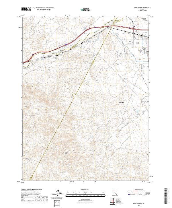
2021 Map of Fernley West
USGS Topo · Published 2021About this map
The Truckee River winds through the northern portion of this landscape, marking a vital water corridor at the edge of the Fortymile Desert. This arid environment is defined by the stark contrast between the natural flow of the river and the engineered paths of the Truckee Canal and the K2B Canal, which support the agricultural and residential development seen in Fernley Valley. To the south, the terrain rises into the northern reaches of the Virginia Range, where isolated water sources like Horse Spring and Freeman Spring provide a glimpse into the region's traditional hydrology before modern irrigation changed the valley floor.
Find a feature on this map
45 named features on this map. Tap any name to fly to it.
Don’t see what you’re looking for? This feature index may not catch every label — zoom into the map to look around manually.
Map Details
Editions of this 2021 Fernley West Map
This is the sole edition of this map. No revisions or reprints were ever made.
Other maps of this area

1890 · Wadsworth
USGS Topo · 1:125,000

1891 · Wabuska
USGS Topo · 1:125,000

1892 · Wadsworth
USGS Topo · 1:125,000

1894 · Wadsworth
USGS Topo · 1:125,000

1894 · Wabuska
USGS Topo · 1:125,000

1957 · Churchill Butte
USGS Topo · 1:62,500

1957 · Two Tips
USGS Topo · 1:62,500

1957 · Wadsworth
USGS Topo · 1:62,500

1957 · Silver Springs
USGS Topo · 1:62,500

1957 · Reno
USGS Topo · 1:250,000