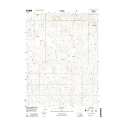
2015 Map of Ferris Creek
USGS Topo · Published 2015About this map
Plumas National Forest dominates this high-elevation landscape where the boundaries of Lassen and Plumas counties meet. The terrain is defined by dramatic peaks and basins, including McKesick Peak and Black Mountain, which overlook a network of seasonal water sources and canyons like Stiles Canyon and Otis Canyon. A complex web of access roads such as the Black Mtn Spur and Plinco Mine Rd suggests a history of resource extraction and forest management, while labels such as Abandoned near Last Chance Creek hint at former routes or sites no longer in active use. The concentration of named springs, including Plinco Sheep Troughs Spring and Granite Spring, points to the critical importance of water management for livestock or early settlers in this arid mountain environment. The map also captures the lower-elevation Honey Lake Valley at the northeastern edge, providing a sharp contrast to the surrounding high country.
Find a feature on this map
44 named features on this map. Tap any name to fly to it.
Don’t see what you’re looking for? This feature index may not catch every label — zoom into the map to look around manually.
Map Details
Editions of this 2015 Ferris Creek Map
This is the sole edition of this map. No revisions or reprints were ever made.
Other maps of this area

1886 · Honey Lake
USGS Topo · 1:250,000

1890 · Sierraville
USGS Topo · 1:125,000

1891 · Honey Lake
USGS Topo · 1:250,000

1892 · Sierraville
USGS Topo · 1:125,000

1893 · Honey Lake
USGS Topo · 1:250,000

1894 · Sierraville
USGS Topo · 1:125,000

1950 · Chilcoot
USGS Topo · 1:62,500

1950 · Portola
USGS Topo · 1:62,500

1950 · Milford
USGS Topo · 1:62,500

1954 · Doyle
USGS Topo · 1:62,500