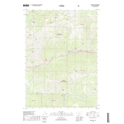
2017 Map of Ferry Peak
USGS Topo · Published 2017About this map
The confluence of the Snake River and Greys River anchors this mountainous corridor along the border of the Targhee National Forest and Bridger National Forest. The landscape is defined by steep vertical relief, rising from the riverbanks to prominent summits like Ferry Peak and Bradley Mtn. Movement through this challenging terrain is dictated by the water, with the Greys River Rd and the Squaw Creek Snowmobile Trail providing the primary access points into the backcountry. Along the southern riverbanks, small landmarks like the Greys River Bridge and Squaw Creek Bridge mark essential crossing points for those navigating the valley floor. To the north, the terrain becomes increasingly complex with deep cuts such as Burnt Timber Canyon and Deadhorse Canyon, leading toward the high ridgelines of the Divide.
Find a feature on this map
54 named features on this map. Tap any name to fly to it.
Don’t see what you’re looking for? This feature index may not catch every label — zoom into the map to look around manually.
Map Details
Editions of this 2017 Ferry Peak Map
This is the sole edition of this map. No revisions or reprints were ever made.
Other maps of this area

1931 · Jackson
USGS Topo · 1:125,000

1932 · Irwin
USGS Topo · 1:96,000

1935 · Irwin
USGS Topo · 1:125,000

1935 · Jackson
USGS Topo · 1:125,000

1955 · Driggs
USGS Topo · 1:250,000

1958 · Driggs
USGS Topo · 1:250,000

1962 · Driggs
USGS Topo · 1:250,000

1963 · Munger Mountain
USGS Topo · 1:24,000

1963 · Observation Peak
USGS Topo · 1:24,000

1963 · Ferry Peak
USGS Topo · 1:24,000