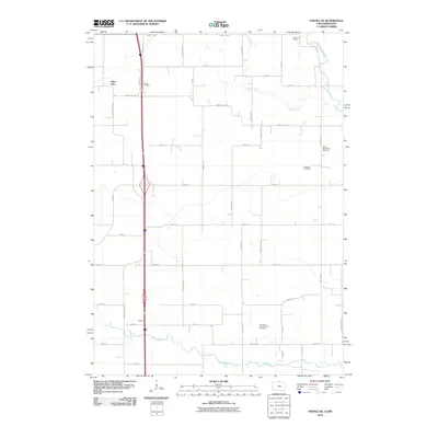
2010 Map of Fertile NE
USGS Topo · Published 2010About this map
Silver Lake sits in the northwest corner of this Worth County landscape, part of a drainage network defined by the Shell Rock River, Goose Creek, and the winding path of Elk Creek. This rural area in northern Iowa, near the Minnesota border, is anchored by the small settlement of Tenold and is characterized by a grid-like road system named largely for birds and plants, including Mockingbird Ave, Kingfisher Ave, and Jonquil Ave. Family and community history is preserved across several burial grounds, such as Towne Cemetery and North Shell Rock Cemetery, which serve as landmarks in the agricultural expanse. The topography includes the Panicum Prairie, reflecting the native land cover that once dominated this region before modern cultivation. The presence of the Elk Creek Number One Cemetery further emphasizes the deep-rooted local heritage found throughout these sections.
Find a feature on this map
38 named features on this map. Tap any name to fly to it.
Don’t see what you’re looking for? This feature index may not catch every label — zoom into the map to look around manually.
Map Details
Editions of this 2010 Fertile NE Map
This is the sole edition of this map. No revisions or reprints were ever made.
Other maps of this area

1954 · Albert Lea
USGS Topo · 1:62,500

1954 · Hayward
USGS Topo · 1:62,500

1954 · Mason City
USGS Topo · 1:250,000

1957 · Mason City
USGS Topo · 1:250,000

1958 · Mason City
USGS Topo · 1:250,000

1972 · Manly
USGS Topo · 1:24,000

1972 · Fertile
USGS Topo · 1:24,000

1972 · Northwood
USGS Topo · 1:24,000

1972 · Fertile NE
USGS Topo · 1:24,000

1972 · Bristol
USGS Topo · 1:24,000