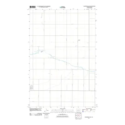
2011 Map of Fessenden East
USGS Topo · Published 2011About this map
The James River snakes through this section of the Great Plains, its course interrupted by the Fessenden Dam. This 2011 survey illustrates a strictly organized landscape of section lines and agricultural grids, characteristic of central Wells County. Much of the activity is centered around the intersection of County Hwy 1 and various numbered streets, including 15th St NE and 23rd St NE. For those researching local history or genealogy, the presence of the Concordia Cemetery east of the river provides a specific point of interest. The map documents the enduring rural road network, from named routes like Hope Ave NE to established corridors such as County Rd 2, reflecting a territory deeply rooted in its pastoral layout.
Find a feature on this map
24 named features on this map. Tap any name to fly to it.
Don’t see what you’re looking for? This feature index may not catch every label — zoom into the map to look around manually.
Map Details
Editions of this 2011 Fessenden East Map
This is the sole edition of this map. No revisions or reprints were ever made.
Other maps of this area

1932 · Flora
USGS Topo · 1:62,500

1943 · Maddock
USGS Topo · 1:62,500

1945 · Maddock
USGS Topo · 1:62,500

1948 · Cathay
USGS Topo · 1:62,500

1948 · Fessenden
USGS Topo · 1:62,500

1948 · Bremen
USGS Topo · 1:24,000

1949 · Bremen
USGS Topo · 1:24,000

1949 · Cathay
USGS Topo · 1:24,000

1949 · Fessenden SW
USGS Topo · 1:24,000

1949 · Fessenden East
USGS Topo · 1:24,000