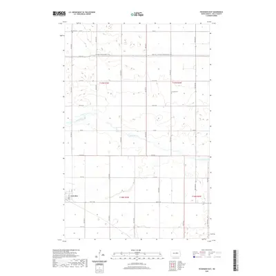
2020 Map of Fessenden East
USGS Topo · Published 2020About this map
Fessenden sits at the edge of this prairie landscape in Wells County, where the grid of rural section lines meets the winding course of the James River. The river carves a serpentine path through the eastern half of the quadrangle, creating a distinct hydrological break in an otherwise orderly agricultural layout. This map serves as a detailed record of land use and connectivity in the early 21st century, showing how modern transit corridors like Co Rd 1 and Co Rd 5 link the county seat to the surrounding townships. Two significant burial sites, Concordia Cem and East Vang Cem, provide anchor points for genealogists researching the Scandinavian and German heritage of the central North Dakota plains. The inclusion of the N Country National Scenic Trail crossing through T149N R70W and T149N R69W highlights the intersection of modern recreational infrastructure with historic agrarian boundaries.
Find a feature on this map
27 named features on this map. Tap any name to fly to it.
Don’t see what you’re looking for? This feature index may not catch every label — zoom into the map to look around manually.
Map Details
Editions of this 2020 Fessenden East Map
This is the sole edition of this map. No revisions or reprints were ever made.
Other maps of this area

1932 · Flora
USGS Topo · 1:62,500

1943 · Maddock
USGS Topo · 1:62,500

1945 · Maddock
USGS Topo · 1:62,500

1948 · Cathay
USGS Topo · 1:62,500

1948 · Fessenden
USGS Topo · 1:62,500

1948 · Bremen
USGS Topo · 1:24,000

1949 · Bremen
USGS Topo · 1:24,000

1949 · Cathay
USGS Topo · 1:24,000

1949 · Fessenden SW
USGS Topo · 1:24,000

1949 · Fessenden East
USGS Topo · 1:24,000