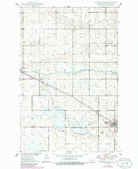
1949 Map of Fessenden West
USGS Topo · Published 1986About this map
The James River meanders across this Wells County landscape, providing a natural contrast to the rigid section lines of the surrounding prairie. This area, documented through surveys in 1948 and updated in the 1980s, highlights the importance of the Soo Line railroad in shaping local development. The rail corridor connects the larger settlement of Fessenden in the southeast to the community of Manfred in the west, illustrating the typical North Dakota pattern of town sites following the steel rails. Local heritage is preserved in the location of rural landmarks like School No 1 and the German Baptist Cem, alongside the Hillside Cem near the Fessenden townsite. South of the river, the terrain descends toward Hirshkorn Lake, showcasing a landscape defined by glacial activity and the agricultural townships of Manfred, West Norway, and Saint Anna.
Find a feature on this map
12 named features on this map. Tap any name to fly to it.
Don’t see what you’re looking for? This feature index may not catch every label — zoom into the map to look around manually.
Map Details
Editions of this 1949 Fessenden West Map
2 editions found
Other maps of this area

1941 · Selz
USGS Topo · 1:62,500

1943 · Maddock
USGS Topo · 1:62,500

1945 · Maddock
USGS Topo · 1:62,500

1945 · Manfred
USGS Topo · 1:62,500

1948 · Fessenden
USGS Topo · 1:62,500

1948 · Manfred
USGS Topo · 1:62,500

1949 · Fessenden SW
USGS Topo · 1:24,000

1949 · Fessenden East
USGS Topo · 1:24,000

1949 · Emrick
USGS Topo · 1:24,000

1949 · Fessenden West
USGS Topo · 1:24,000