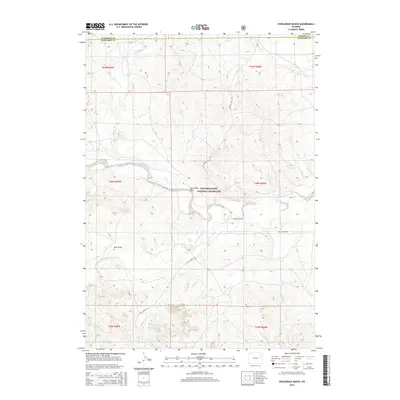
2015 Map of Fiddleback Ranch
USGS Topo · Published 2015About this map
The Thunder Basin National Grassland dominates this high plains landscape at the intersection of Campbell, Converse, and Weston Counties. The namesake Fiddleback Ranch serves as a central landmark in a region defined by an extensive network of ephemeral waterways and drainage basins. The Cheyenne River and its tributary, the Dry Fork Cheyenne River, carve through the terrain, joined by smaller systems like Antelope Cr, Horse Cr, and Lake Cr. This survey illustrates the sparse, ranch-oriented settlement patterns of the Wyoming basin, where long-distance routes such as Rochelle Hills Rd and Dull Center Rd provide the primary infrastructure across the vast sections. Geographical features like Sauerkraut Draw and Vest Draw reflect the localized naming traditions of the cattle country in the early twenty-first century.
Find a feature on this map
21 named features on this map. Tap any name to fly to it.
Don’t see what you’re looking for? This feature index may not catch every label — zoom into the map to look around manually.
Map Details
Editions of this 2015 Fiddleback Ranch Map
This is the sole edition of this map. No revisions or reprints were ever made.
Other maps of this area

1955 · Newcastle
USGS Topo · 1:250,000

1958 · Newcastle
USGS Topo · 1:250,000

1971 · Fiddleback Ranch
USGS Topo · 1:24,000

1971 · Coal Bank Draw
USGS Topo · 1:24,000

1971 · Esau Spring
USGS Topo · 1:24,000

1971 · Piney Canyon SW
USGS Topo · 1:24,000

1971 · Piney Canyon SE
USGS Topo · 1:24,000

1971 · Tin Can Lake
USGS Topo · 1:24,000

1974 · Reno Junction
USGS Topo · 1:100,000

1979 · Newcastle
USGS Topo · 1:100,000