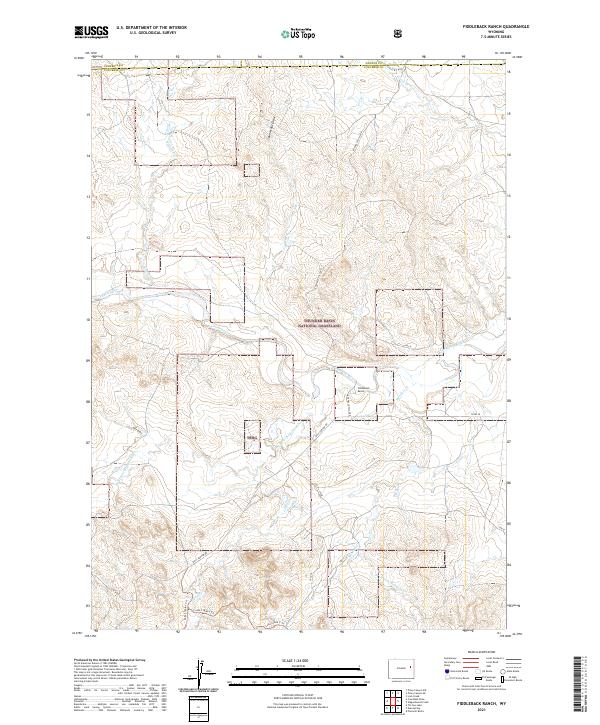
2021 Map of Fiddleback Ranch
USGS Topo · Published 2021About this map
Thunder Basin National Grassland dominates this high plains landscape in eastern Wyoming, where the Fiddleback Ranch remains a central point of human settlement. The drainage network is particularly intricate, defined by the convergence of the Cheyenne River and the Dry Fork Cheyenne River. These waterways, along with tributaries like Antelope Cr and Meadow Cr, carved the draws and creek beds that have dictated movement through this territory for generations. The road network is sparse, centered on Rochelle Hills Rd and Dull Center Rd, which follow the natural contours of the land. This map reveals the transition of the Powder River Basin as it moves toward the Black Hills, showing a region where names like Sauerkraut Draw and Vest Draw reflect the legacy of early ranching and water rights.
Find a feature on this map
26 named features on this map. Tap any name to fly to it.
Don’t see what you’re looking for? This feature index may not catch every label — zoom into the map to look around manually.
Map Details
Editions of this 2021 Fiddleback Ranch Map
This is the sole edition of this map. No revisions or reprints were ever made.
Other maps of this area

1955 · Newcastle
USGS Topo · 1:250,000

1958 · Newcastle
USGS Topo · 1:250,000

1971 · Fiddleback Ranch
USGS Topo · 1:24,000

1971 · Coal Bank Draw
USGS Topo · 1:24,000

1971 · Esau Spring
USGS Topo · 1:24,000

1971 · Piney Canyon SW
USGS Topo · 1:24,000

1971 · Piney Canyon SE
USGS Topo · 1:24,000

1971 · Tin Can Lake
USGS Topo · 1:24,000

1974 · Reno Junction
USGS Topo · 1:100,000

1979 · Newcastle
USGS Topo · 1:100,000