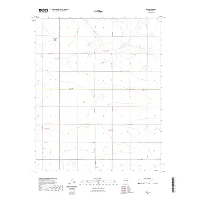
2023 Map of Field
USGS Topo · Published 2023About this map
Field sits at the southern end of this High Plains landscape, marking a localized pocket of settlement near the boundary line of Quay Co Curry Co. The area is defined by its vast agricultural and ranching grid, where drainage patterns like Blanco Creek and Frio Draw break the otherwise flat terrain of the eastern New Mexico plains. These natural features dictated the early placement of ranch holdings and transport routes before the modern road system was established.
Find a feature on this map
33 named features on this map. Tap any name to fly to it.
Don’t see what you’re looking for? This feature index may not catch every label — zoom into the map to look around manually.
Map Details
Editions of this 2023 Field Map
This is the sole edition of this map. No revisions or reprints were ever made.
Other maps of this area

1954 · Clovis
USGS Topo · 1:250,000

1957 · Hammond Ranch
USGS Topo · 1:62,500

1958 · Clovis
USGS Topo · 1:250,000

1971 · Ragland
USGS Topo · 1:24,000

1971 · Grady SW
USGS Topo · 1:24,000

1971 · Forrest
USGS Topo · 1:24,000

1973 · Weber City
USGS Topo · 1:24,000

1973 · Field SE
USGS Topo · 1:24,000

1973 · Field SW
USGS Topo · 1:24,000
1973 · Field
USGS Topo · 1:24,000