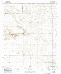
1973 Map of Field SW
USGS Topo · Published 1987About this map
Alamosa Creek winds through the high plains at the intersection of Quay, Curry, and Roosevelt counties, carving a distinct drainage through an otherwise expansive landscape of contour-defined plateaus. This 1973 survey, updated with 1983 aerial revisions, captures the agrarian character of the High Plains where water is the primary driver of human activity. The map depicts a sparse network of section lines and ranch roads supporting a cattle and dry-land farming economy, evidenced by the presence of a Silo and scattered wells providing vital water for livestock. In the southeastern corner, the depression of Brooks Lake offers a rare natural catch basin in a region dominated by the ephemeral flow of the creek. This topographical record is particularly valuable for understanding the hydrology of the New Mexico panhandle before modern irrigation and development patterns further altered the surface landscape.
Find a feature on this map
8 named features on this map. Tap any name to fly to it.
Don’t see what you’re looking for? This feature index may not catch every label — zoom into the map to look around manually.
Map Details
Editions of this 1973 Field SW Map
2 editions found
Other maps of this area

1954 · Clovis
USGS Topo · 1:250,000

1957 · Melrose
USGS Topo · 1:62,500

1958 · Clovis
USGS Topo · 1:250,000

1972 · Melrose East
USGS Topo · 1:24,000

1973 · Weber City
USGS Topo · 1:24,000

1973 · Krider
USGS Topo · 1:24,000

1973 · Field SE
USGS Topo · 1:24,000

1973 · Melrose West
USGS Topo · 1:24,000

1973 · Mc Alister
USGS Topo · 1:24,000

1973 · Field SW
USGS Topo · 1:24,000