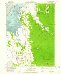
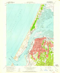
1959 Map of Fields Landing
USGS Topo · Published 1961About this map
Humboldt Bay and its southern reaches define this 1959 coastal survey, where the timber and rail infrastructure of Northern California is clearly visible. The Northwestern Pacific railroad tracks hug the shoreline, connecting waterfront settlements like Fields Landing and King Salmon to the inland agricultural and milling sites. The map documents the intricate hydrology of the tidelands, from the deep Hookton Channel to the expansive mudflats and South Bay salt marshes.
Find a feature on this map
59 named features on this map. Tap any name to fly to it.
Don’t see what you’re looking for? This feature index may not catch every label — zoom into the map to look around manually.
Map Details
Editions of this 1959 Fields Landing Map
4 editions found
Other maps of this area

1916 · Cape Fortunas
USGS Topo · 1:62,500

1922 · Eureka
USGS Topo · 1:62,500

1933 · Eureka
USGS Topo · 1:48,000

1942 · Eureka
USGS Topo · 1:62,500

1943 · Ferndale
USGS Topo · 1:62,500

1944 · Fortuna
USGS Topo · 1:62,500

1949 · Eureka
USGS Topo · 1:250,000

1951 · Eureka
USGS Topo · 1:62,500

1951 · Ferndale
USGS Topo · 1:62,500
1958 · Eureka
USGS Topo · 1:24,000