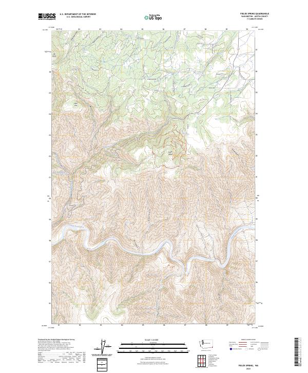
2023 Map of Fields Spring
USGS Topo · Published 2023About this map
The Fields Spring recreation area occupies a high-elevation vantage point in the Blue Mountains of southeast Washington, where the land drops precipitously into the canyons of the Grande Ronde River. The landscape is defined by its extreme vertical relief, transitioning from the basalt summits of Big Butte and Puffer Butte down to the river’s winding course. Access through this complex terrain is managed by a network of forest roads and trails, including Shumaker Grade Rd and the Mountain View Trl, which navigate the steep slopes between Benson Ridge and Montgomery Ridge.
Find a feature on this map
42 named features on this map. Tap any name to fly to it.
Don’t see what you’re looking for? This feature index may not catch every label — zoom into the map to look around manually.
Map Details
Editions of this 2023 Fields Spring Map
This is the sole edition of this map. No revisions or reprints were ever made.
Other maps of this area

1943 · Saddle Butte
USGS Topo · 1:62,500

1944 · Anatone
USGS Topo · 1:62,500

1946 · Saddle Butte
USGS Topo · 1:62,500

1946 · Anatone
USGS Topo · 1:62,500

1955 · Pullman
USGS Topo · 1:250,000

1955 · Grangeville
USGS Topo · 1:250,000

1958 · Pullman
USGS Topo · 1:250,000

1959 · Grangeville
USGS Topo · 1:250,000
1967 · Paradise
USGS Topo · 1:24,000
1967 · Teepee Butte
USGS Topo · 1:24,000