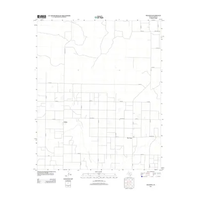
2012 Map of Fieldton
USGS Topo · Published 2012About this map
Fieldton and the nearby community of Hart Camp anchor this 2012 survey of the Texas High Plains in Lamb County. The landscape is defined by a rigorous grid of section lines and rural thoroughfares, including Fm-168 and Ranch Road 37. This layout reflects the area's deep-rooted agricultural structure, where wide-open spaces are punctuated by occasional playas and the winding traces of ephemeral drainage. Notable local arteries like Ranch Road 1072 and Ranch Road 1071 connect isolated farmsteads to these small central hubs. The U.S. Geological Survey mapping captures the region during a period of sustained agricultural use, showing how modern transportation such as Fm-37 maintains the connectivity between these remote West Texas settlements.
Find a feature on this map
22 named features on this map. Tap any name to fly to it.
Don’t see what you’re looking for? This feature index may not catch every label — zoom into the map to look around manually.
Map Details
Editions of this 2012 Fieldton Map
This is the sole edition of this map. No revisions or reprints were ever made.
Other maps of this area

1954 · Clovis
USGS Topo · 1:250,000

1954 · Brownfield
USGS Topo · 1:250,000

1957 · Anton
USGS Topo · 1:62,500

1958 · Brownfield
USGS Topo · 1:250,000

1958 · Clovis
USGS Topo · 1:250,000

1962 · Brownfield
USGS Topo · 1:250,000

1962 · Cofferville
USGS Topo · 1:24,000

1962 · Springlake
USGS Topo · 1:24,000

1962 · Fieldton
USGS Topo · 1:24,000

1963 · Olton
USGS Topo · 1:24,000