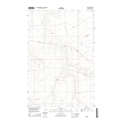
2014 Map of Fife
USGS Topo · Published 2014About this map
Fife sits at the junction of the northern high plains and the rugged drainage systems that define this portion of Cascade County. The landscape is characterized by deep erosional features like Rogers Coulee and Antelope Coulee, where seasonal waterways have carved significant relief into the terrain. Transport in the early 21st century follows a mix of established highways and family-named routes, with Us-87 and MT-3 providing the primary transit corridor through the region. Water remains the primary shaper of the land here, as the meandering paths of Box Elder Cr, Shellrock Cr, and Spring Cr create a complex network of valleys and ridges. Local transit and land access are facilitated by a grid of named rural roads, including Bickford Rd, Hastings Rd, and Bob Gordon Ln, which connect the scattered agricultural holdings across the township boundaries.
Find a feature on this map
20 named features on this map. Tap any name to fly to it.
Don’t see what you’re looking for? This feature index may not catch every label — zoom into the map to look around manually.
Map Details
Editions of this 2014 Fife Map
This is the sole edition of this map. No revisions or reprints were ever made.
Other maps of this area

1886 · Great Falls
USGS Topo · 1:250,000

1890 · Fort Benton
USGS Topo · 1:250,000

1892 · Fort Benton
USGS Topo · 1:250,000

1897 · Fort Benton
USGS Topo · 1:250,000

1948 · Portage
USGS Topo · 1:62,500

1949 · Portage
USGS Topo · 1:62,500

1954 · Great Falls
USGS Topo · 1:250,000

1954 · Waltham
USGS Topo · 1:24,000

1955 · Stockett
USGS Topo · 1:62,500

1956 · Highwood
USGS Topo · 1:62,500