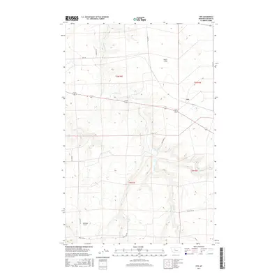
2017 Map of Fife
USGS Topo · Published 2017About this map
Fife sits along the northern reaches of the Highwood Mountains foothills, characterized by a complex network of coulees and seasonal drainages. The landscape is defined by its agricultural and ranching orientation, with arterial routes like Swift Rd and Fife Rd connecting the scattered homesteads and property boundaries. The terrain is deeply incised by watercourses such as Box Elder Cr, which meanders through the central portion of the survey, and Spring Cr to the south. Distinctive geographic markers like Rogers Coulee in the northeast and Antelope Coulee in the southwest illustrate the topographic variation of this Montana landscape. Local named roads like Bob Gordon Ln and Rickard Rd provide a clear view of the rural infrastructure and land management patterns in Cascade County during the early 21st century.
Find a feature on this map
18 named features on this map. Tap any name to fly to it.
Don’t see what you’re looking for? This feature index may not catch every label — zoom into the map to look around manually.
Map Details
Editions of this 2017 Fife Map
This is the sole edition of this map. No revisions or reprints were ever made.
Other maps of this area

1886 · Great Falls
USGS Topo · 1:250,000

1890 · Fort Benton
USGS Topo · 1:250,000

1892 · Fort Benton
USGS Topo · 1:250,000

1897 · Fort Benton
USGS Topo · 1:250,000

1948 · Portage
USGS Topo · 1:62,500

1949 · Portage
USGS Topo · 1:62,500

1954 · Great Falls
USGS Topo · 1:250,000

1954 · Waltham
USGS Topo · 1:24,000

1955 · Stockett
USGS Topo · 1:62,500

1956 · Highwood
USGS Topo · 1:62,500