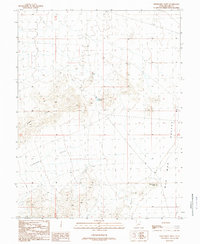
1989 Map of Fifteenmile Point
USGS Topo · Published 1989About this map
Gray Hills dominate the western portion of this Millard County landscape, overlooking the broad expanse of Lawson Cove and the eastern edge of the Wah Wah Valley. This 1989 provisional map, based on field checks from the mid-1980s, documents a high-desert environment where water management is critical for survival and land use. The presence of the Lawson Cove Reservoir, a Ditch, and a specifically labeled Check Dam indicates the infrastructure required to harness seasonal runoff in an otherwise arid basin. While the map shows minimal permanent settlement, the inclusion of a Corral and several unimproved trails suggests the area's continued importance for open-range ranching. To the southeast, the terrain rises toward the prominent landmark of Fifteenmile Point, providing a clear survey of the transition from the valley floor to the adjacent upland benches.
Find a feature on this map
10 named features on this map. Tap any name to fly to it.
Don’t see what you’re looking for? This feature index may not catch every label — zoom into the map to look around manually.
Map Details
Editions of this 1989 Fifteenmile Point Map
This is the sole edition of this map. No revisions or reprints were ever made.
Other maps of this area

1953 · Richfield
USGS Topo · 1:250,000

1958 · Richfield
USGS Topo · 1:250,000

1960 · Frisco Peak
USGS Topo · 1:62,500

1960 · Wah Wah Summit
USGS Topo · 1:62,500

1960 · Crystal Peak
USGS Topo · 1:62,500

1960 · The Barn
USGS Topo · 1:62,500

1980 · Wah Wah Mts. North
USGS Topo · 1:100,000
1989 · Frisco Peak
USGS Topo · 1:24,000
1989 · Wah Wah Cove
USGS Topo · 1:24,000
1989 · Wah Wah Summit
USGS Topo · 1:24,000