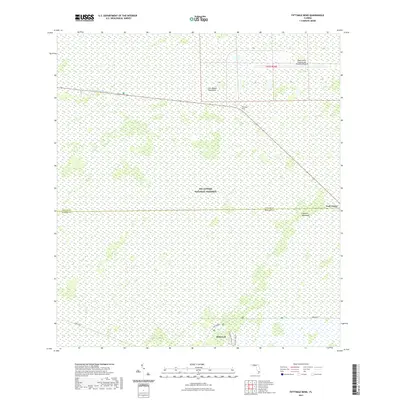
2021 Map of Fiftymile Bend
USGS Topo · Published 2021About this map
Big Cypress National Preserve dominates this section of the Florida Everglades, revealing the intricate water-and-land patterns of the subtropical wilderness. The landscape is defined by the Tamiami Canal Number C-4 and the critical intersection at Fiftymile Bend, where transit corridors cut through the swamp. The survey details specific ecological features like Corn Dance Hammock and the Roberts Lakes Strand, reflecting the varying elevations that allow for hardwood growth amidst the wetlands.
Find a feature on this map
15 named features on this map. Tap any name to fly to it.
Don’t see what you’re looking for? This feature index may not catch every label — zoom into the map to look around manually.
Map Details
Editions of this 2021 Fiftymile Bend Map
This is the sole edition of this map. No revisions or reprints were ever made.
Other maps of this area

1956 · Miami
USGS Topo · 1:250,000

1958 · Miami
USGS Topo · 1:250,000

1972 · Shark Valley Lookout Tower
USGS Topo · 1:24,000

1972 · Monroe Station NE
USGS Topo · 1:24,000

1972 · Lostmans Trail
USGS Topo · 1:24,000

1972 · Big Boy Lake
USGS Topo · 1:24,000

1973 · Fortymile Bend
USGS Topo · 1:24,000

1973 · Fiftymile Bend
USGS Topo · 1:24,000

1973 · North Of Fiftymile Bend
USGS Topo · 1:24,000

1973 · Monroe Station
USGS Topo · 1:24,000