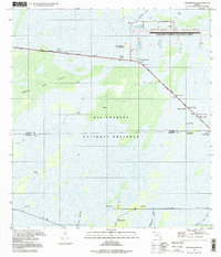
1995 Map of Fiftymile Bend
USGS Topo · Published 1999About this map
Big Cypress National Preserve dominates this landscape, showing a complex network of wetlands and hammocks in the mid-1990s. The map illustrates the specialized infrastructure of the Everglades, from the Dade-Collier Transition and Training Airport to the industrial presence of an oil well and radio tower near Pinecrest. Transportation is defined by the Tamiami Trail and its accompanying Tamiami Canal, which served as a primary artery for South Florida travel and drainage.
Find a feature on this map
27 named features on this map. Tap any name to fly to it.
Don’t see what you’re looking for? This feature index may not catch every label — zoom into the map to look around manually.
Map Details
Editions of this 1995 Fiftymile Bend Map
This is the sole edition of this map. No revisions or reprints were ever made.
Other maps of this area

1956 · Miami
USGS Topo · 1:250,000

1958 · Miami
USGS Topo · 1:250,000

1972 · Shark Valley Lookout Tower
USGS Topo · 1:24,000

1972 · Monroe Station NE
USGS Topo · 1:24,000

1972 · Lostmans Trail
USGS Topo · 1:24,000

1972 · Big Boy Lake
USGS Topo · 1:24,000

1973 · Fortymile Bend
USGS Topo · 1:24,000

1973 · Fiftymile Bend
USGS Topo · 1:24,000

1973 · North Of Fiftymile Bend
USGS Topo · 1:24,000

1973 · Monroe Station
USGS Topo · 1:24,000