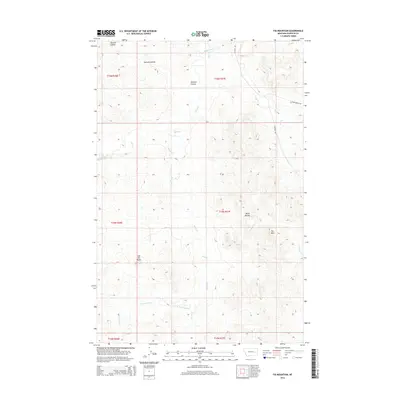
2014 Map of Fig Mountain
USGS Topo · Published 2014About this map
Fig Mtn and the surrounding Garfield County badlands define this landscape of high plains and deeply incised drainages. The area is characterized by isolated geological formations such as the Black Buttes and the prominent Joe Ott Butte, which stand as landmarks above a network of seasonal watercourses. Large-scale ranching and land management are evident through the township and range survey lines, with narrow tracks like Lacosta Rd and Sand Arroyo Dr providing the few corridors of access through the territory. The complex hydrology of the region is traced through the winding paths of Sand Creek, Basin Cr, and Tepee Cr, which cut through the dry terrain. The presence of Harston Coulee in the northwest corner suggests the erosional forces that have shaped this portion of the Montana interior, where water management and topographical navigation remain central to local life.
Find a feature on this map
18 named features on this map. Tap any name to fly to it.
Don’t see what you’re looking for? This feature index may not catch every label — zoom into the map to look around manually.
Map Details
Editions of this 2014 Fig Mountain Map
This is the sole edition of this map. No revisions or reprints were ever made.
Other maps of this area

1954 · Jordan
USGS Topo · 1:250,000

1954 · Forsyth
USGS Topo · 1:250,000

1956 · Jordan
USGS Topo · 1:250,000

1957 · Forsyth
USGS Topo · 1:250,000

1958 · Jordan
USGS Topo · 1:250,000

1958 · Forsyth
USGS Topo · 1:250,000

1964 · Jordan
USGS Topo · 1:250,000

1965 · Big Dry School
USGS Topo · 1:24,000

1965 · Darby Buttes
USGS Topo · 1:24,000

1965 · Kramer Ranch
USGS Topo · 1:24,000