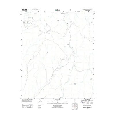
2012 Map of Figueroa Mountain
USGS Topo · Published 2012About this map
Figueroa Mountain and Cachuma Mountain anchor this landscape within Santa Barbara County, where rugged backcountry topography is defined by deep canyons and prominent ridges. The area is a network of remote outposts and historic cattle interests, with Marre Ranch and Tunnel Ranch situated among the lower drainage basins. This map documents a series of trail camps and access points, including Figueroa Camp, Junction Camp, and the distant Manzana Camp near Hells Half Acre. Several significant water sources are vital to this terrain, notably Cachuma Cr, Davy Brown Cr, and Soldiers Home Spring. The presence of De la Guerra Camp reflects the deep local history of early California land grants and families that once managed these vast mountain tracts.
Find a feature on this map
42 named features on this map. Tap any name to fly to it.
Don’t see what you’re looking for? This feature index may not catch every label — zoom into the map to look around manually.
Map Details
Editions of this 2012 Figueroa Mountain Map
This is the sole edition of this map. No revisions or reprints were ever made.
Other maps of this area

1902 · Santa Ynez
USGS Topo · 1:125,000

1905 · Santa Ynez
USGS Topo · 1:125,000

1905 · Lompoc
USGS Topo · 1:125,000

1941 · San Rafael Mtn.
USGS Topo · 1:62,500

1941 · McPherson Peak
USGS Topo · 1:62,500

1942 · Lompoc
USGS Topo · 1:125,000

1942 · San Rafael Mtn.
USGS Topo · 1:62,500

1942 · Tepusquet Peak
USGS Topo · 1:62,500

1942 · Los Olivos
USGS Topo · 1:62,500

1943 · San Rafael Mtn.
USGS Topo · 1:62,500